Dies ist eine interaktive Karte! Verwende die Steuerelemente zum schwenken und zoomen.
Zugang
|
English (Übersetze diesen text in Deutsch): Head for Othmans Reef, then at the final dune, turn right along the beach. Cross the sabkha till you get to the first dune at the sea edge. Not accessible at some states of the tide.
English (Übersetze diesen text in Deutsch): Head for Othmans Reef, then at the final dune, turn right along the beach. Cross the sabkha till you get to the first dune at the sea edge. Not accessible at some states of the tide.
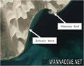
Head for Othmans Reef, then at the final dune, turn right along the beach. Cross the sabkha till you get to the first dune at the sea edge. Not accessible at some states of the tide.
English (Übersetze diesen text in Deutsch): Head for Othmans Reef, then at the final dune, turn right along the beach. Cross the sabkha till you get to the first dune at the sea edge. Not accessible at some states of the tide.
English (Übersetze diesen text in Deutsch): Head for Othmans Reef, then at the final dune, turn right along the beach. Cross the sabkha till you get to the first dune at the sea edge. Not accessible at some states of the tide.
English (Übersetze diesen text in Deutsch): Head for Othmans Reef, then at the final dune, turn right along the beach. Cross the sabkha till you get to the first dune at the sea edge. Not accessible at some states of the tide.
English (Übersetze diesen text in Deutsch): Head for Othmans Reef, then at the final dune, turn right along the beach. Cross the sabkha till you get to the first dune at the sea edge. Not accessible at some states of the tide.
English (Übersetze diesen text in Deutsch): Head for Othmans Reef, then at the final dune, turn right along the beach. Cross the sabkha till you get to the first dune at the sea edge. Not accessible at some states of the tide.
English (Übersetze diesen text in Deutsch): Head for Othmans Reef, then at the final dune, turn right along the beach. Cross the sabkha till you get to the first dune at the sea edge. Not accessible at some states of the tide.
Wie? Vom Ufer
Entfernung Kurzer Fußweg vom Ufer (< 5min)
Leicht zu finden? Schwer zu finden
|
|
Tauchplatz Merkmale
Alternativer Name Olivier Bank reef
Durchschnittstiefe 7 m / 23 ft
max. Tiefe 9 m / 29.5 ft
Strömung Niedrig ( < 1 Knoten)
Sichtweite Mittel ( 5 - 10 m)
Qualität
Tauchplatz Qualität Standard
Erfahrung Alle Taucher
Biointeresse Interessant
Mehr Details
Wochenaufkommen
Wochenendaufkommen
Art des Tauchgangs
- Riff
Tauchplatz Aktivitäten
- Meeresbiologie
Gefahren
Zusätzliche Informationen
English (Übersetze diesen text in Deutsch): 3 natural coral reefs. Named for Olivier, the club member who found the reef. Zeitoune is Arabic for olive.
Often rays on sandy crossing. The southernmost reef often has large hamour Fish at the bottom of the reef wall.
As you swim the gap, the depth will decrease as you approach the reef. If it starts getting quite deep, it means you have passed it. Turn back to shallow area, then turn either North or South
3 natural coral reefs. Named for Olivier, the club member who found the reef. Zeitoune is Arabic for olive.
Often rays on sandy crossing. The southernmost reef often has large hamour Fish at the bottom of the reef wall.
As you swim the gap, the depth will decrease as you approach the reef. If it starts getting quite deep, it means you have passed it. Turn back to shallow area, then turn either North or South
English (Übersetze diesen text in Deutsch): 3 natural coral reefs. Named for Olivier, the club member who found the reef. Zeitoune is Arabic for olive.
Often rays on sandy crossing. The southernmost reef often has large hamour Fish at the bottom of the reef wall.
As you swim the gap, the depth will decrease as you approach the reef. If it starts getting quite deep, it means you have passed it. Turn back to shallow area, then turn either North or South
 Kommentare
Zeige alle (0)...
Sei der erste der einen Kommentar über dieses Land schreibt
Errors, Feedback
Du kannst diese Seite ändern um Fehler zu beheben oder neue Information hinzuzufügen. Wenn du Probleme mit der Seite hast, Schicken Sie uns Ihr Feedback.
Wannadive.net 24/24
Wannadive.net auf deinem Handy

Newsletter Alle News per Email
 Zeitoune Bank