Passwort verloren? Neuer Benutzer? Registrieren
Whale Shark, Philippines. Photo by Stephane Rochon.
Genieße und Trage etwas bei!
| Finde den besten Tauchplatz |
|
|
![]() Mayotte
Mayotte
Afrika
Ort: Southern Indian Ocean, island in the Mozambique Channel, about half way between northern Madagascar and northern Mozambique
Geografische Koordinaten: 12° 30' S, 45° 6' E
Küste km: 185.2 km km
Klima: tropical; marine; hot, humid, rainy season during northeastern monsoon (November to May); dry season is cooler (May to November)
Gelände: generally undulating, with deep ravines and ancient volcanic peaks
Höhe: lowest point: Indian Ocean 0 m
highest point: Benara 660 m
Natürliche Gefahren: cyclones during rainy season
Währung: euros (EUR)
Bevölkerung: 223,765 (July 2009 est.)
Sprachen: Mahorian (a Swahili dialect), French (official language) spoken by 35% of the population
Hauptstadt: Mamoudzou
Bereiche: none (territorial overseas collectivity of France)
Mehr Details
| Jan | Feb | Mar | Apr | May | Jun | Jul | Aug | Sep | Oct | Nov | Dec | |
|---|---|---|---|---|---|---|---|---|---|---|---|---|
| Climate | ||||||||||||
| Air temp. | ||||||||||||
| Water temp. | ||||||||||||
| Equipment | ||||||||||||
| Best season | ||||||||||||
Möchtest du Informationen über Mayotte hinzufügen? Lass es uns wissen ...
Dies ist eine interaktive Karte! Verwende die Steuerelemente zum schwenken und zoomen.
- Tauch logs (0)
- ausflüge (0)
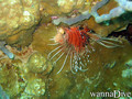
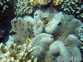
- Fotos (4)
- Videos (0)
- Teile
- Favorit
-
Deine Favoriten und zukünftigen Tauchplatzlisten
Tauchplätze
| Tauchplätze (3) | Qualität | Durchschnittstiefe | Max. Tiefe | Erfahrung | Art des Tauchgangs | ||
|---|---|---|---|---|---|---|---|
| Mtsangamouji | - / - | 4 m | 50 m | Alle Taucher | 


|
||
| Passe bandrélé - Les ancres | - / - | 10 m | 18 m | Alle Taucher |
|
||
| Passe en S | 4 / - | 15 m | 25 m | Keine Ahnung | 
|


 Kommentare
Sei der erste der einen Kommentar über dieses Land schreibt
Errors, Feedback
Wenn du neue Information hinzufügen möchtest, oder Fehler in diesem Land gefunden hast, Schicken Sie uns Ihr Feedback.
Bewerbe
Wannadive.net 24/24
Wannadive.net auf deinem Handy
![]()
RSS Alle RSS-Feeds von Wannadive.net
Newsletter Alle News per Email