Passwort verloren? Neuer Benutzer? Registrieren
Big eye, Philippines. Photo by Stephane Rochon.
Genieße und Trage etwas bei!
| Finde den besten Tauchplatz |
|
|
 Burma
Burma
Asien
Burma, officially the Union of Myanmar, is the largest country by geographical area in mainland Southeast Asia or Indochina. The country is bordered by China on the northeast, Laos on the east, Thailand on the southeast, Bangladesh on the west, India on the northwest and the Bay of Bengal to the southwest with the Andaman Sea defining its southern periphery. One-third of Burma's total perimeter, 1,930 kilometres (1,199 mi), forms an uninterrupted coastline.
Ort: Southeastern Asia, bordering the Andaman Sea and the Bay of Bengal, between Bangladesh and Thailand
Geografische Koordinaten: 22° 0' N, 98° 0' E
Küste km: 1,930 km km
Klima: tropical monsoon; cloudy, rainy, hot, humid summers (southwest monsoon, June to September); less cloudy, scant rainfall, mild temperatures, lower humidity during winter (northeast monsoon, December to April)
Gelände: central lowlands ringed by steep, rugged highlands
Höhe: lowest point: Andaman Sea 0 m
highest point: Hkakabo Razi 5,881 m
Natürliche Gefahren: petroleum, timber, tin, antimony, zinc, copper, tungsten, lead, coal, marble, limestone, precious stones, natural gas, hydropower
Währung: kyats (MMK)
Bevölkerung: 48,137,741 (July 2009 est.)
Sprachen: Burmese, minority ethnic groups have their own languages
Hauptstadt: Rangoon (Yangon)
Bereiche: 7 divisions and 7 states:
- divisions: Ayeyarwady, Bago, Magway, Mandalay, Sagaing, Tanintharyi, Yangon
- states: Chin, Kachin, Kayah, Kayin, Mon, Rakhine, Shan
Mehr Details
| Jan | Feb | Mar | Apr | May | Jun | Jul | Aug | Sep | Oct | Nov | Dec | |
|---|---|---|---|---|---|---|---|---|---|---|---|---|
| Climate | ||||||||||||
| Air temp. | ||||||||||||
| Water temp. | ||||||||||||
| Equipment | ||||||||||||
| Best season | ||||||||||||
Zusätzliche Karte
Möchtest du Informationen über Burma hinzufügen? Lass es uns wissen ...
Dies ist eine interaktive Karte! Verwende die Steuerelemente zum schwenken und zoomen.
- Tauch logs (0)
- ausflüge (0)
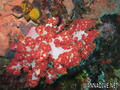
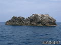
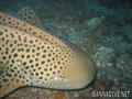
- Fotos (7)
- Videos (4)
- Teile
- Favorit
-
Deine Favoriten und zukünftigen Tauchplatzlisten
Deine bevorzugte Zone ist nicht aufgeführt? Neue Zone hinzufügen
Zonen
| Zonen (1) | Tauchplätze | Sub Zonen |
|---|---|---|
| Mergui Archipelago | 6 | 0 |
Tauchplätze
| Tauchplätze (1) | Qualität | Durchschnittstiefe | Max. Tiefe | Erfahrung | Art des Tauchgangs | ||
|---|---|---|---|---|---|---|---|
| Silvertip Bank | - / - | 18 m | 30 m | CMAS * / OW | 
|
 Videos
 04:54
04:54
|
 04:00
04:00
|
 04:13
04:13
|
 03:32
03:32
|
Kommentare
Errors, Feedback
Wenn du neue Information hinzufügen möchtest, oder Fehler in diesem Land gefunden hast, Schicken Sie uns Ihr Feedback.
Bewerbe
Wannadive.net 24/24
Wannadive.net auf deinem Handy
![]()
RSS Alle RSS-Feeds von Wannadive.net
Newsletter Alle News per Email