Passwort verloren? Neuer Benutzer? Registrieren
Big eye, Philippines. Photo by Stephane Rochon.
Genieße und Trage etwas bei!
| Finde den besten Tauchplatz |
|
|
![]() Mala acantilado izquierda
Mala acantilado izquierda
Canary, Lanzarote
Dies ist eine interaktive Karte! Verwende die Steuerelemente zum schwenken und zoomen.
|
Datum: WGS84 [ Hilfe ] |
Breitengrad: 29° 5.006' N |
Benutzer Bewertung (0)
- Favorit
-
Deine Favoriten und zukünftigen Tauchplatzlisten
Zugang
|
English (Übersetze diesen text in Deutsch): First, you've to reach Mala by road, and then, by a rock stairs, you access to a rock platform, and after that, to the sea by a ladder. Wie? Vom Ufer Entfernung Kurzer Fußweg vom Ufer (< 5min) Leicht zu finden? Leicht zu finden |
Tauchplatz Merkmale
Durchschnittstiefe 15 m / 49.2 ft
max. Tiefe 30 m / 98.4 ft
Strömung Niedrig ( < 1 Knoten)
Sichtweite Gut ( 10 - 30 m)
Qualität
Tauchplatz Qualität Gut
Erfahrung CMAS * / OW
Biointeresse Interessant
Mehr Details
Wochenaufkommen
Wochenendaufkommen
Art des Tauchgangs
- Wand
- Höhle
- Riff
- Ambiente
- Seicht
Tauchplatz Aktivitäten
- Meeresbiologie
- Photography
Gefahren
Zusätzliche Informationen
Verfasser: Athe Mitarbeiter (1) Sie tauchten den Tauchplatz! (1)
 Fotos
Fotos
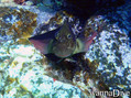
Mala acantilado izquierda |
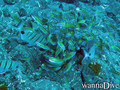
Mala acantilado izquierda |
Tauchtrips
|
Kommentare
Sei der erste der einen Kommentar über dieses Land schreibt
Errors, Feedback
Du kannst diese Seite ändern um Fehler zu beheben oder neue Information hinzuzufügen. Wenn du Probleme mit der Seite hast, Schicken Sie uns Ihr Feedback.
Bewerbe
Wannadive.net 24/24
Wannadive.net auf deinem Handy
![]()
RSS Alle RSS-Feeds von Wannadive.net
Newsletter Alle News per Email