logo

Clownfish, Philippines. Photo by Stephane Rochon.

Ein Tauchplatz Atlas gemacht von Tauchern für Taucher
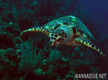
Genieße und Trage etwas bei!

 Ãštila Island

Honduras, Bay Islands

English (Übersetze diesen text in Deutsch): Útila (Isla de Útila) is the third largest of Honduras' Bay Islands, after Roatán and Guanaja, in a region that marks the south end of the Mesoamerican Barrier Reef System, the second-largest in the world. The eastern end of the island is capped by a thin veneer of basaltic volcanic rocks, erupted from several pyroclastic cones including 74 m (243 ft) Pumpkin Hill which forms the highest point on the island. It has been documented in history since Columbus' fourth voyage, and currently enjoys growing tourism with emphasis on recreational diving.

English (Übersetze diesen text in Deutsch): Útila (Isla de Útila) is the third largest of Honduras' Bay Islands, after Roatán and Guanaja, in a region that marks the south end of the Mesoamerican Barrier Reef System, the second-largest in the world. The eastern end of the island is capped by a thin veneer of basaltic volcanic rocks, erupted from several pyroclastic cones including 74 m (243 ft) Pumpkin Hill which forms the highest point on the island. It has been documented in history since Columbus' fourth voyage, and currently enjoys growing tourism with emphasis on recreational diving.

Útila (Isla de Útila) is the third largest of Honduras' Bay Islands, after Roatán and Guanaja, in a region that marks the south end of the Mesoamerican Barrier Reef System, the second-largest in the world. The eastern end of the island is capped by a thin veneer of basaltic volcanic rocks, erupted from several pyroclastic cones including 74 m (243 ft) Pumpkin Hill which forms the highest point on the island. It has been documented in history since Columbus' fourth voyage, and currently enjoys growing tourism with emphasis on recreational diving.

English (Übersetze diesen text in Deutsch): Útila (Isla de Útila) is the third largest of Honduras' Bay Islands, after Roatán and Guanaja, in a region that marks the south end of the Mesoamerican Barrier Reef System, the second-largest in the world. The eastern end of the island is capped by a thin veneer of basaltic volcanic rocks, erupted from several pyroclastic cones including 74 m (243 ft) Pumpkin Hill which forms the highest point on the island. It has been documented in history since Columbus' fourth voyage, and currently enjoys growing tourism with emphasis on recreational diving.

English (Übersetze diesen text in Deutsch): Útila (Isla de Útila) is the third largest of Honduras' Bay Islands, after Roatán and Guanaja, in a region that marks the south end of the Mesoamerican Barrier Reef System, the second-largest in the world. The eastern end of the island is capped by a thin veneer of basaltic volcanic rocks, erupted from several pyroclastic cones including 74 m (243 ft) Pumpkin Hill which forms the highest point on the island. It has been documented in history since Columbus' fourth voyage, and currently enjoys growing tourism with emphasis on recreational diving.

English (Übersetze diesen text in Deutsch): Útila (Isla de Útila) is the third largest of Honduras' Bay Islands, after Roatán and Guanaja, in a region that marks the south end of the Mesoamerican Barrier Reef System, the second-largest in the world. The eastern end of the island is capped by a thin veneer of basaltic volcanic rocks, erupted from several pyroclastic cones including 74 m (243 ft) Pumpkin Hill which forms the highest point on the island. It has been documented in history since Columbus' fourth voyage, and currently enjoys growing tourism with emphasis on recreational diving.

English (Übersetze diesen text in Deutsch): Útila (Isla de Útila) is the third largest of Honduras' Bay Islands, after Roatán and Guanaja, in a region that marks the south end of the Mesoamerican Barrier Reef System, the second-largest in the world. The eastern end of the island is capped by a thin veneer of basaltic volcanic rocks, erupted from several pyroclastic cones including 74 m (243 ft) Pumpkin Hill which forms the highest point on the island. It has been documented in history since Columbus' fourth voyage, and currently enjoys growing tourism with emphasis on recreational diving.

English (Übersetze diesen text in Deutsch): Útila (Isla de Útila) is the third largest of Honduras' Bay Islands, after Roatán and Guanaja, in a region that marks the south end of the Mesoamerican Barrier Reef System, the second-largest in the world. The eastern end of the island is capped by a thin veneer of basaltic volcanic rocks, erupted from several pyroclastic cones including 74 m (243 ft) Pumpkin Hill which forms the highest point on the island. It has been documented in history since Columbus' fourth voyage, and currently enjoys growing tourism with emphasis on recreational diving.

English (Übersetze diesen text in Deutsch): Útila (Isla de Útila) is the third largest of Honduras' Bay Islands, after Roatán and Guanaja, in a region that marks the south end of the Mesoamerican Barrier Reef System, the second-largest in the world. The eastern end of the island is capped by a thin veneer of basaltic volcanic rocks, erupted from several pyroclastic cones including 74 m (243 ft) Pumpkin Hill which forms the highest point on the island. It has been documented in history since Columbus' fourth voyage, and currently enjoys growing tourism with emphasis on recreational diving.

Mehr Details

 
Saisons
Jan Feb Mar Apr May Jun Jul Aug Sep Oct Nov Dec
Climate                        
Air temp.                        
Water temp.                        
Equipment
Best season                        

Willst du diese zusätzlichen Daten korrigieren oder vervollständigen? Editiere diese Seite

Dies ist eine interaktive Karte! Verwende die Steuerelemente zum schwenken und zoomen.

Dein bevorzugter Tauchplatz ist nicht aufgeführt? Einen Tauchplatz hinzufügen

Tauchplätze

Tauchplätze (21)
Qualität Durchschnittstiefe Max. Tiefe Erfahrung Art des Tauchgangs
Airport Caves - / - 32.8 ft 59.1 ft {SPOT_DIVE_TYPE}
Aquarium - / - 49.9 ft 60 ft {SPOT_DIVE_TYPE}
Black Corral Wall - / - 15.1 ft 129.9 ft {SPOT_DIVE_TYPE}
Black Hills 3 / - 39.4 ft 98.4 ft {SPOT_DIVE_TYPE}
Blackish Point - / - 49.2 ft 85.3 ft {SPOT_DIVE_TYPE}
CJ's Dropoff - / - 49.9 ft 120.1 ft {SPOT_DIVE_TYPE}
Duppy Waters 1 / - 49.2 ft 98.4 ft {SPOT_DIVE_TYPE}
Eagle Ray Alley - / - 49.2 ft 78.7 ft {SPOT_DIVE_TYPE}
Great Wall - / - 65.6 ft 95.1 ft {SPOT_DIVE_TYPE}
Halliburton 2 / - 88.6 ft 101.7 ft {SPOT_DIVE_TYPE}
Jack's Bight - / - 20 ft 65 ft {SPOT_DIVE_TYPE}
Little Bight - / - 23 ft 98.4 ft {SPOT_DIVE_TYPE}
moon hole - / - 15.1 ft 80.1 ft {SPOT_DIVE_TYPE}
Old House 2 / - 49.2 ft 131.2 ft {SPOT_DIVE_TYPE}
Raggedy Cay - / - 49.2 ft 98.4 ft {SPOT_DIVE_TYPE}
Ships Stern - / - 49.2 ft 82 ft {SPOT_DIVE_TYPE}
Silver Garden - / - 29.9 ft 120.1 ft {SPOT_DIVE_TYPE}
Sting Ray Point - / - 49.9 ft 76.1 ft {SPOT_DIVE_TYPE}
Ted's Point West - / - 49.9 ft 59.1 ft {SPOT_DIVE_TYPE}
The Maze - / - 49.2 ft 131.2 ft {SPOT_DIVE_TYPE}
Utila Open Water 1 / - 9.8 ft 49.2 ft {SPOT_DIVE_TYPE}

 Videos

Zeige alle (0)...

Kein Video verfügbar

 Tauchlogs

Zeige alle (0)...

No dive log

 Tauchtrips

Zeige alle (0)...

No dive trip

 Kommentare

Kommentar hinzufügen

Zeige alle (0)...

Sei der erste der einen Kommentar über dieses Land schreibt

Errors, Feedback

Du kannst diese Seite ändern um Fehler zu beheben oder neue Information hinzuzufügen. Wenn du Probleme mit der Seite hast, Schicken Sie uns Ihr Feedback.

Bewerbe

Wannadive.net 24/24

Wannadive.net auf deinem Handy

Google Play Application

RSS Alle RSS-Feeds von Wannadive.net

Newsletter Alle News per Email