Passwort verloren? Neuer Benutzer? Registrieren
Whale Shark, Philippines. Photo by Stephane Rochon.
Genieße und Trage etwas bei!
| Finde den besten Tauchplatz |
|
|
 Cook Islands
Australien & Pazifik
Ort: Oceania, group of islands in the South Pacific Ocean, about one-half of the way from Hawaii to New Zealand
Geografische Koordinaten: 21° 14' S, 159° 46' W
Küste km: 120 km km
Klima: tropical oceanic; moderated by trade winds; a dry season from April to November and a more humid season from December to March
Gelände: low coral atolls in north; volcanic, hilly islands in south
Höhe: lowest point: Pacific Ocean 0 m
highest point: Te Manga 652 m
Natürliche Gefahren: typhoons (November to March)
Währung: NZ dollar (NZD)
Bevölkerung: 21,750 (July 2007 est.)
Sprachen: English (official), Maori
Hauptstadt: Avarua
Bereiche:
Mehr Details
| Jan | Feb | Mar | Apr | May | Jun | Jul | Aug | Sep | Oct | Nov | Dec | |
|---|---|---|---|---|---|---|---|---|---|---|---|---|
| Climate | ||||||||||||
| Air temp. | ||||||||||||
| Water temp. | ||||||||||||
| Equipment | ||||||||||||
| Best season | ||||||||||||
Zusätzliche Karte
Möchtest du Informationen über Cook Islands hinzufügen? Lass es uns wissen ...
Dies ist eine interaktive Karte! Verwende die Steuerelemente zum schwenken und zoomen.
- Tauch logs (0)
- ausflüge (0)
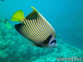
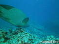
- Fotos (36)
- Videos (0)
- Teile
- Favorit
-
Deine Favoriten und zukünftigen Tauchplatzlisten
Deine bevorzugte Zone ist nicht aufgeführt? Neue Zone hinzufügen
Zonen
| Zonen (2) | Tauchplätze | Sub Zonen |
|---|---|---|
| Aitutaki | 1 | 0 |
| Rarotonga | 4 | 0 |
 Fotos
Fotos
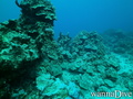
Aruntanga Passage |

Aruntanga Passage |
Aruntanga Passage |
Alberto s |
Kommentare
Errors, Feedback
Wenn du neue Information hinzufügen möchtest, oder Fehler in diesem Land gefunden hast, Schicken Sie uns Ihr Feedback.
Bewerbe
Wannadive.net 24/24
Wannadive.net auf deinem Handy
![]()
RSS Alle RSS-Feeds von Wannadive.net
Newsletter Alle News per Email