Passwort verloren? Neuer Benutzer? Registrieren
Whale Shark, Philippines. Photo by Stephane Rochon.
Genieße und Trage etwas bei!
| Finde den besten Tauchplatz |
|
|
 Russia
Asien
Ort: Northern Asia (the area west of the Urals is considered part of Europe), bordering the Arctic Ocean, between Europe and the North Pacific Ocean
Geografische Koordinaten: 60° 0' N, 100° 0' E
Küste km: 37,653 km km
Klima: ranges from steppes in the south through humid continental in much of European Russia; subarctic in Siberia to tundra climate in the polar north; winters vary from cool along Black Sea coast to frigid in Siberia; summers vary from warm in the steppes to cool along Arctic coast
Gelände: broad plain with low hills west of Urals; vast coniferous forest and tundra in Siberia; uplands and mountains along southern border regions
Höhe: lowest point: Caspian Sea -28 m
highest point: Gora El'brus 5,633 m
Natürliche Gefahren: permafrost over much of Siberia is a major impediment to development; volcanic activity in the Kuril Islands; volcanoes and earthquakes on the Kamchatka Peninsula; spring floods and summer/autumn forest fires throughout Siberia and parts of European Russia.
Währung: Russian ruble (RUR)
Bevölkerung: 141,377,752 (July 2007 est.)
Sprachen: Russian, many minority languages
Hauptstadt: Moscow
Bereiche: 12 regions: Central, Central Black Earth, East Siberian, Far Eastern, Northern, North Caucasus, Northwestern, Volga, Urals, Volga-Vyatka, West Siberian, Kaliningrad
Mehr Details
| Jan | Feb | Mar | Apr | May | Jun | Jul | Aug | Sep | Oct | Nov | Dec | |
|---|---|---|---|---|---|---|---|---|---|---|---|---|
| Climate | ||||||||||||
| Air temp. | ||||||||||||
| Water temp. | ||||||||||||
| Equipment | Não sei | Não sei | Não sei | Não sei | Não sei | Não sei | Não sei | Não sei | Não sei | Não sei | Não sei | Não sei |
| Best season | ||||||||||||
Zusätzliche Karte
Möchtest du Informationen über Russia hinzufügen? Lass es uns wissen ...
Dies ist eine interaktive Karte! Verwende die Steuerelemente zum schwenken und zoomen.
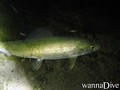
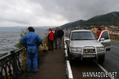
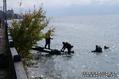
- Tauch logs (15)
- ausflüge (0)
- Fotos (93)
- Videos (0)
- Teile
- Favorit
-
Deine Favoriten und zukünftigen Tauchplatzlisten
Deine bevorzugte Zone ist nicht aufgeführt? Neue Zone hinzufügen
Zonen
| Zonen (5) | Tauchplätze | Sub Zonen |
|---|---|---|
| Baikal | 13 | 0 |
| Central | 11 | 0 |
| North Caucasus | 6 | 0 |
| Primorsky Krai | 9 | 0 |
| Ural | 3 | 0 |
Tauchplätze
| Tauchplätze (8) | Qualität | Durchschnittstiefe | Max. Tiefe | Erfahrung | Art des Tauchgangs | ||
|---|---|---|---|---|---|---|---|
| Bungur Black island | - / - | 15 m | 40 m | Alle Taucher | 
|
||
| Ingol' Lake | 2 / - | 20 m | 94 m | Alle Taucher |


|
||
| Konopelka | 2 / - | 9 m | 15 m | Alle Taucher |
|
||
| Lake Teletskoye | - / - | 7 m | 325 m | Alle Taucher |

|
||
| Lake Vad | 5 / - | m | m | Alle Taucher |
|
||
| Oazis | 3 / - | 9 m | 13 m | CMAS * / OW |

|
||
| Temir | 3 / - | 40 m | 100 m | Alle Taucher | 
|
||
| Zaboy | 3 / - | 5 m | 8 m | CMAS * / OW |
|

 Tauchlogs
|
Kommentare
Sei der erste der einen Kommentar über dieses Land schreibt
Errors, Feedback
Wenn du neue Information hinzufügen möchtest, oder Fehler in diesem Land gefunden hast, Schicken Sie uns Ihr Feedback.
Bewerbe
Wannadive.net 24/24
Wannadive.net auf deinem Handy
![]()
RSS Alle RSS-Feeds von Wannadive.net
Newsletter Alle News per Email