Passwort verloren? Neuer Benutzer? Registrieren
Lizard fish, Philippines. Photo by Stephane Rochon.
Genieße und Trage etwas bei!
| Finde den besten Tauchplatz |
|
|
 India
India
Asien
Ort: Southern Asia, bordering the Arabian Sea and the Bay of Bengal, between Burma and Pakistan
Geografische Koordinaten: 20° 0' N, 77° 0' E
Küste km: 7,000 km km
Klima: varies from tropical monsoon in south to temperate in north
Gelände: upland plain (Deccan Plateau) in south, flat to rolling plain along the Ganges, deserts in west, Himalayas in north
Höhe:
Natürliche Gefahren: droughts; flash floods, as well as widespread and destructive flooding from monsoonal rains; severe thunderstorms; earthquakes
Währung: Indian rupee (INR)
Bevölkerung:
Sprachen: English enjoys associate status but is the most important language for national, political, and commercial communication; Hindi is the national language and primary tongue of 30% of the people
Hauptstadt:
Bereiche:
Mehr Details
| Jan | Feb | Mar | Apr | May | Jun | Jul | Aug | Sep | Oct | Nov | Dec | |
|---|---|---|---|---|---|---|---|---|---|---|---|---|
| Climate | ||||||||||||
| Air temp. | ||||||||||||
| Water temp. | ||||||||||||
| Equipment | ||||||||||||
| Best season | ||||||||||||
Möchtest du Informationen über India hinzufügen? Lass es uns wissen ...
Dies ist eine interaktive Karte! Verwende die Steuerelemente zum schwenken und zoomen.
- Tauch logs (4)
- ausflüge (1)
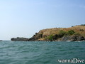
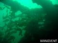
- Fotos (12)
- Videos (0)
- Teile
- Favorit
-
Deine Favoriten und zukünftigen Tauchplatzlisten
Deine bevorzugte Zone ist nicht aufgeführt? Neue Zone hinzufügen
Zonen
| Zonen (3) | Tauchplätze | Sub Zonen |
|---|---|---|
| Andaman Islands | 2 | 0 |
| Goa | 3 | 0 |
| South India | 2 | 1 |


 Tauchlogs
|
Tauchtrips
|
Kommentare
Sei der erste der einen Kommentar über dieses Land schreibt
Errors, Feedback
Wenn du neue Information hinzufügen möchtest, oder Fehler in diesem Land gefunden hast, Schicken Sie uns Ihr Feedback.
Bewerbe
Wannadive.net 24/24
Wannadive.net auf deinem Handy
![]()
RSS Alle RSS-Feeds von Wannadive.net
Newsletter Alle News per Email