Passwort verloren? Neuer Benutzer? Registrieren
Lizard fish, Philippines. Photo by Stephane Rochon.
Genieße und Trage etwas bei!
| Finde den besten Tauchplatz |
|
|
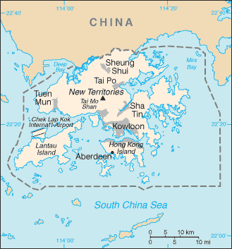
 Hong Kong
Asien
Ort: Eastern Asia, bordering the South China Sea and China
Geografische Koordinaten: 22° 15' N, 114° 10' E
Küste km: 733 km km
Klima: subtropical monsoon; cool and humid in winter, hot and rainy from spring through summer, warm and sunny in fall
Gelände: hilly to mountainous with steep slopes; lowlands in north
Höhe:
Natürliche Gefahren: occasional typhoons
Währung: Hong Kong dollar (HKD)
Bevölkerung:
Sprachen: Chinese (Cantonese) 89.2% (official), other Chinese dialects 6.4%, English 3.2% (official), other 1.2% (2001 census)
Hauptstadt:
Bereiche: none (special administrative region of China)
Mehr Details
| Jan | Feb | Mar | Apr | May | Jun | Jul | Aug | Sep | Oct | Nov | Dec | |
|---|---|---|---|---|---|---|---|---|---|---|---|---|
| Climate | ||||||||||||
| Air temp. | ||||||||||||
| Water temp. | ||||||||||||
| Equipment | Je ne sais pas | Je ne sais pas | Je ne sais pas | Je ne sais pas | Je ne sais pas | Je ne sais pas | Je ne sais pas | Je ne sais pas | Je ne sais pas | Je ne sais pas | Je ne sais pas | Je ne sais pas |
| Best season | ||||||||||||
Zusätzliche Karte
Möchtest du Informationen über Hong Kong hinzufügen? Lass es uns wissen ...
Dies ist eine interaktive Karte! Verwende die Steuerelemente zum schwenken und zoomen.
- Tauch logs (0)
- ausflüge (0)
- Fotos (0)
- Videos (0)
- Teile
- Favorit
-
Deine Favoriten und zukünftigen Tauchplatzlisten
Deine bevorzugte Zone ist nicht aufgeführt? Neue Zone hinzufügen
Zonen
| Zonen (1) | Tauchplätze | Sub Zonen |
|---|---|---|
| Ninepin Group | 1 | 0 |
Tauchplätze
| Tauchplätze (2) | Qualität | Durchschnittstiefe | Max. Tiefe | Erfahrung | Art des Tauchgangs | ||
|---|---|---|---|---|---|---|---|
| Sharp Island | - / - | 6 m | 10 m | Alle Taucher | |||
| Trio Island | - / - | 15 m | 20 m | CMAS ** / AOW | 

|
 Kommentare
Sei der erste der einen Kommentar über dieses Land schreibt
Errors, Feedback
Wenn du neue Information hinzufügen möchtest, oder Fehler in diesem Land gefunden hast, Schicken Sie uns Ihr Feedback.
Bewerbe
Wannadive.net 24/24
Wannadive.net auf deinem Handy
![]()
RSS Alle RSS-Feeds von Wannadive.net
Newsletter Alle News per Email