Passwort verloren? Neuer Benutzer? Registrieren
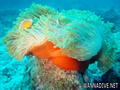
Clownfish, Philippines. Photo by Stephane Rochon.
Genieße und Trage etwas bei!
| Finde den besten Tauchplatz |
|
|
 Seychelles
Afrika
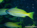
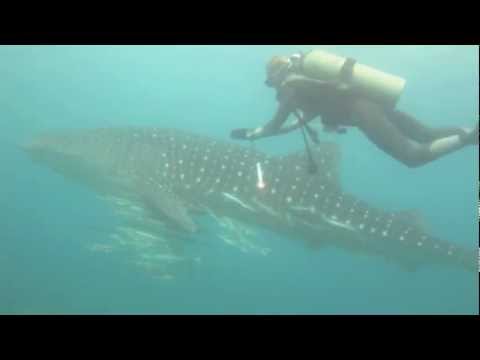
The marine life around the islands, especially the more remote coral islands, can be spectacular. More than 1000 species of fish have been recorded. Since the use of spearguns and dynamite for fishing was banned through efforts of local conservationists in the 1960s, the wildlife is unafraid of snorkelers and divers. Coral bleaching in 1998 has unfortunately damaged most reefs. The reefs comprise of a vast selection of soft corals and hard corals alike. There is great diving and snorkeling opportunity. The taking of marine turtles was completely stopped in 1994, turtle populations are now recovering on several islands, most notably Cousin Island, Silhouette Island and Aldabra. The use of gill nets for shark fishing as well as the practice of shark finning are now banned.
Ort: Archipelago in the Indian Ocean, northeast of Madagascar
Geografische Koordinaten: 4° 35' S, 55° 40' E
Küste km: 491 km km
Klima: tropical marine; humid; cooler season during southeast monsoon (late May to September); warmer season during northwest monsoon (March to May)
Gelände: Mahe Group is granitic, narrow coastal strip, rocky, hilly; others are coral, flat, elevated reefs
Höhe: lowest point: Indian Ocean 0 m
highest point: Morne Seychellois 905 m
Natürliche Gefahren: lies outside the cyclone belt, so severe storms are rare; short droughts possible
Währung: Seychelles rupee (SCR)
Bevölkerung: 81,895 (July 2007 est.)
Sprachen: Creole 91.8%, English 4.9% (official), other 3.1%, unspecified 0.2% (2002 census)
Hauptstadt: Victoria
Bereiche: 23 administrative districts; Anse aux Pins, Anse Boileau, Anse Etoile, Anse Louis, Anse Royale, Baie Lazare, Baie Sainte Anne, Beau Vallon, Bel Air, Bel Ombre, Cascade, Glacis, Grand' Anse (on Mahe), Grand' Anse (on Praslin), La Digue, La Riviere Anglaise, Mont Buxton, Mont Fleuri, Plaisance, Pointe La Rue, Port Glaud, Saint Louis, Takamaka
Mehr Details
| Jan | Feb | Mar | Apr | May | Jun | Jul | Aug | Sep | Oct | Nov | Dec | |
|---|---|---|---|---|---|---|---|---|---|---|---|---|
| Climate | ||||||||||||
| Air temp. | ||||||||||||
| Water temp. | ||||||||||||
| Equipment | Don't know | Don't know | Don't know | Don't know | Don't know | Don't know | Don't know | Don't know | Don't know | Don't know | Don't know | Don't know |
| Best season | ||||||||||||
Zusätzliche Karte
Möchtest du Informationen über Seychelles hinzufügen? Lass es uns wissen ...
Dies ist eine interaktive Karte! Verwende die Steuerelemente zum schwenken und zoomen.
- Tauch logs (3)
- ausflüge (0)
- Fotos (38)
- Videos (2)
- Teile
- Favorit
-
Deine Favoriten und zukünftigen Tauchplatzlisten
Deine bevorzugte Zone ist nicht aufgeführt? Neue Zone hinzufügen
Zonen
| Zonen (2) | Tauchplätze | Sub Zonen |
|---|---|---|
| Inner Islands | 31 | 5 |
| Outer Islands | 6 | 0 |
 Fotos
Fotos
Bay Ternay Marine Park |

Bay Ternay Marine Park |
Beau Vallon Reef |

Beau Vallon Reef |
Tauchlogs
|
Kommentare
Von peru , 03-09-2017
REMIRE island - E' l'isola riservata del Presidente delle Seychelles. Ci sono stato nel 1998 con la mia imbarcazione, ancorandomi a nord (200 mt dall'isola dove ci sono banchi di sabbia a - 5/6 mt.) Ho fatto belle immersioni sull'im-menso reef a nor/est. Rifornito la cambusa (aragoste, trovate nel reef a ovest (-2/3 mt, a 100 mt dall'isola)
Errors, Feedback
Wenn du neue Information hinzufügen möchtest, oder Fehler in diesem Land gefunden hast, Schicken Sie uns Ihr Feedback.
Bewerbe
Wannadive.net 24/24
Wannadive.net auf deinem Handy
![]()
RSS Alle RSS-Feeds von Wannadive.net
Newsletter Alle News per Email